
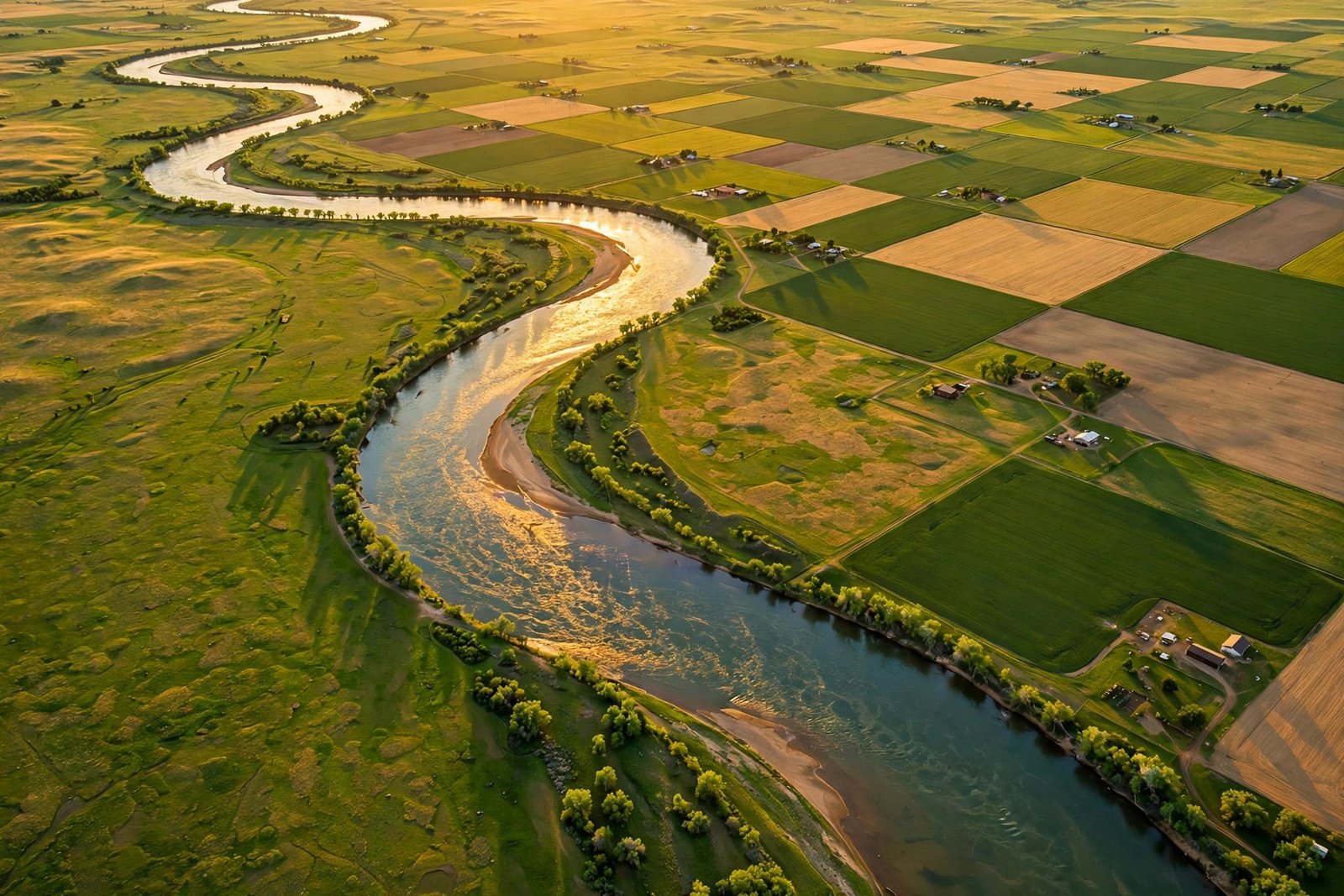
Ask an American to name the longest river in the United States and most will answer the Mississippi. It is the famous one, the river of Mark Twain and steamboats and blues songs. But the correct answer, according to the U.S. Geological Survey, is a surprise: the Missouri River, at 2,540 miles, is longer than the Mississippi, which measures 2,340 miles. The Missouri is not just a tributary with a trivia win, either. Together with the Mississippi below their meeting point at St. Louis, the two form one of the great river systems on Earth.
River lengths are trickier than they look. Where does a river begin — at the source stream that carries its name, or at the most distant headwater, whatever it is called? How do you measure a channel that bends, braids and shifts with every flood? The USGS is candid about this: river-length figures are affected by measurement methods, map scales and somewhat arbitrary decisions about sources. That is why different sources sometimes disagree by tens of miles. But on the headline question, the modern consensus is clear: the Missouri is America’s longest river.
The top of the list
The USGS list of rivers 600 miles or longer in the United States and Canada puts the Missouri first at 2,540 miles and the Mississippi second at 2,340 miles. The Yukon follows at 1,980 miles, though much of its course runs through Canada. The Rio Grande and the St. Lawrence each measure about 1,900 miles. After them come the Arkansas at 1,469 miles, the Colorado at 1,450 miles, the Ohio at 1,310 miles, the Red River at 1,290 miles and the Brazos at 1,280 miles. You can see the USGS’s full list here.
The Missouri flows entirely within the United States, crossing seven states — Montana, North Dakota, South Dakota, Nebraska, Iowa, Kansas and Missouri — from its beginnings in the Rocky Mountains to its meeting with the Mississippi near St. Louis. The Mississippi, by contrast, runs from Lake Itasca in Minnesota through the center of the country to the Gulf of Mexico, passing through ten states. Both rivers are giants. The Missouri simply runs a little farther to get to the same meeting point.
Why the Mississippi gets the glory
If the Missouri is longer, why does the Mississippi get the name, the songs and the fame? History and exploration order are a large part of the answer. The Mississippi was explored and named first in its upper reaches, and as explorers worked downstream they kept the name. When the two rivers meet, the combined river keeps the Mississippi name, even though the Missouri contributes the longer course and, by some measures, the greater flow at the confluence.
There is a long-standing argument, beloved especially in Montana, that the whole system should have been called the Missouri from the Rockies to the Gulf. By the rules of naming, the argument goes, the longer tributary should take precedence, and the upper Mississippi should be treated as the tributary. Combined as the Mississippi-Missouri system, the river stretches about 3,710 miles from the most distant headwaters to the Gulf, making it one of the longest river systems in the world — often ranked fourth globally, behind the Nile, the Amazon and the Yangtze.
Culture did the rest. The Mississippi became the river of American literature and music: Twain’s Huckleberry Finn, the steamboat era, the blues of the Delta. The Missouri, for all its length, became the river of the Lewis and Clark expedition and of westward expansion — historically important, but less romantic in the popular imagination.
A river that built a country
Both rivers shaped American history in ways that go far beyond trivia. The Mississippi was the great north-south highway of the continent long before railroads, carrying grain, cotton, timber and people. New Orleans, at its mouth, became one of America’s great cities precisely because it controlled the river’s outlet to the sea — which is why the port was so important in the Louisiana Purchase of 1803 that it helped trigger the deal.
The Missouri was the highway west. The Lewis and Clark expedition followed it upstream in 1804 and 1805, and steamboats later carried fur traders, settlers and supplies deep into the interior. The river’s floods were legendary and destructive, and the twentieth century answered with a system of dams and reservoirs — including the massive Garrison, Oahe and Fort Peck dams — that tamed the river for navigation, irrigation, flood control and hydropower, while also changing its ecology in profound ways.
Today both rivers remain working rivers. Barges carry grain and goods along the Mississippi and the lower Missouri. Cities from Minneapolis to Memphis to New Orleans depend on the Mississippi for water, commerce and identity. And both rivers face modern pressures: flood risk in a changing climate, sediment and nutrient runoff, aging locks and dams, and the long ecological shadow of channelization.
The rest of America’s great rivers
Beyond the top two, the list rewards a closer look. The Yukon, winding through Alaska and Canada, is a wilderness river of gold-rush fame. The Rio Grande forms much of the U.S.-Mexico border and is a lifeline for arid country, fought over by farmers, cities and ecosystems alike. The Colorado carved the Grand Canyon and supplies water to tens of millions of people in the Southwest, though it now regularly fails to reach the sea. The Ohio, formed at Pittsburgh, carries more water than the Mississippi at their meeting point in Cairo, Illinois, and was the great migration route into the early West.
The Arkansas, the Red, the Brazos and the Columbia — the great river of the Pacific Northwest, famous for salmon and hydropower — each anchor a region’s history and economy. Even rivers that do not make the length charts, like the Hudson, the Columbia’s tributary the Snake, or the short but mighty Potomac, punch far above their mileage in American life.
How river lengths are measured — and why they change
Part of the fun of river trivia is that the numbers move. A river’s length depends on where you start counting, and rivers themselves change: channels shift, meanders get cut off, reservoirs drown stretches of free-flowing river, and better mapping refines old estimates. Older sources sometimes listed the Mississippi as longer than the Missouri, and some still give the Mississippi as 2,350 miles rather than 2,340. GPS-based measurement has largely settled the Missouri’s lead, but the exact figures will keep being refined.
That is worth remembering whenever a ranking is presented as exact. River lengths are best understood as careful estimates, not surveyor’s certainties. The USGS’s own guidance says as much. What does not change is the order at the top: Missouri first, Mississippi second, and the two of them together forming a system that drains much of a continent.
Where the rivers end
Both rivers end in the Gulf of Mexico, but they arrive there very differently. The Mississippi builds a vast delta in Louisiana, a shifting landscape of marshes, bayous and barrier islands that supports fisheries, migratory birds and the port complex of New Orleans. That delta is also disappearing: levees built for flood control have starved it of the sediment that once rebuilt it, and coastal Louisiana loses land every year. The Missouri, by contrast, ends quietly, joining the Mississippi near St. Louis and giving up its name. Its water continues south under another river’s banner, through Memphis and Vicksburg and Natchez, past Baton Rouge, and out into the Gulf — a reminder that rivers, like histories, do not always keep the names they started with.
Seeing the rivers for yourself
The best way to grasp the scale of these rivers is to stand where they meet. At the confluence near St. Louis, the muddy Missouri slides into the Mississippi, and the combined river turns south toward the Gulf. Far upstream, the Missouri begins as a clear mountain stream in Montana; far north, the Mississippi begins as a trickle out of Lake Itasca in Minnesota that you can reportedly walk across. Between those humble sources and the Gulf lies nearly the whole story of American expansion, commerce and culture.
National parks, wildlife refuges and riverfront trails line both rivers, from the Upper Mississippi River National Wildlife and Fish Refuge to the Missouri National Recreational River in South Dakota and Nebraska. A river trip — even a short one, on a paddleboat in St. Louis or a kayak on a quiet stretch — gives a sense of scale that no list of mileages can match.
Related reading
For more American engineering and history, read How the Erie Canal Changed America Forever, Hoover Dam: The Concrete Giant That Built the West, and The American Bison Comeback: Return of the Herds.
Frequently asked questions
What is the longest river in the United States? The Missouri River, at 2,540 miles according to the USGS, is the longest river in the United States.
How long is the Mississippi River? The Mississippi measures 2,340 miles from Lake Itasca in Minnesota to the Gulf of Mexico, making it the second-longest river in the country.
Why is the Mississippi more famous if the Missouri is longer? The Mississippi was explored and named first, and it kept its name below the confluence at St. Louis. Literature, music and the steamboat era then made it the iconic American river.
How long is the Mississippi-Missouri system combined? Measured from the most distant headwaters to the Gulf, the combined system is about 3,710 miles, one of the longest river systems in the world.
Which states does the Missouri River cross? The Missouri crosses seven states: Montana, North Dakota, South Dakota, Nebraska, Iowa, Kansas and Missouri.